A Battlefield Walk
2.5 miles on footpaths across grassland, metalled lane and arable fields. If you wish to see and to walk along the causeway linking Northey island to the mainland then you will need to check the tide tables on the web or with the local TIC. It is not necessary to enter Northey Island to fully appreciate the battlefield terrain, but if you wish to do so then please remember prior permission is required from the National Trust.
There are toilets in Promenade Park while in Maldon town centre there are a wide range of shops, pubs and restaurants as well as car parks and toilets. The walk described here is meant to be used in conjunction with the Battlefield Explorer map, which can be downloaded from the Media Store.
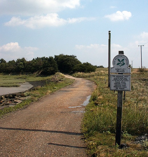
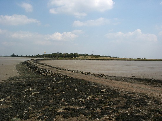
From the car park at the north east corner of Promenade Park take the footpath leading south eastward through the Park. You approach the edge of the saltings along the Blackwater estuary just across the access lane to the recycling centre. Continue along the clearly marked path by the edge of the saltings with the high chain-link fence of the landfill site on your right. The higher ground within the fence is a result of modern dumping. Once past the landfill site the path passes through a gate and then along the flood bank. There is now open farmland on the right and on your left Northey Island can be seen across the saltings and mud flats (or water if you have arrived at high tide). After a short distance you will reach the lane leading to the causeway to the Island. The flood bank was constructed many centuries after the battle, to protect the area from rising sea levels, but today it provides an excellent viewing platform to survey the whole landscape.
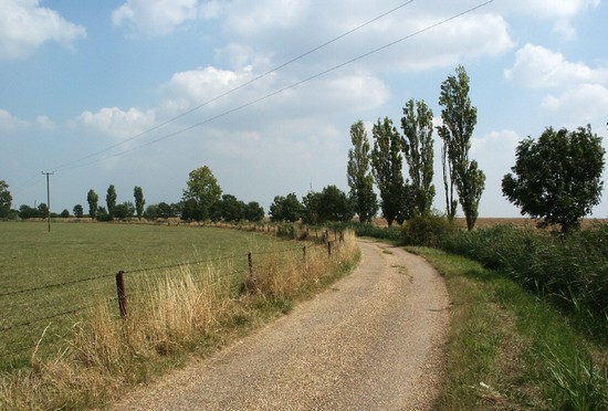
If it is low tide then it is possible to walk along the causeway to get a better feel for the landscape, but do not enter the island without permission. If you feel that the distance from the island is too great for the two sides to have carried out a shouted negotiation before the tide fell, then remember that when the battle was fought sea level was significantly lower. The channel dividing the Island from the mainland was somewhat narrower than it is today and little or no saltings between the land and the water. Return to the mainland and continue along the lane, over the flood bank and down onto the natural ground level. Continue along the lane towards South House Farm. It is immediately apparent that the ground immediately to your left and that in the distance on which the farm stands is significantly higher than where the lane runs. The area on which you are standing and to your right is covered by alluvium deposited by the flood waters that still periodically affected this land as late as the 19th century. The alluvium has been deposited since 991, when this was perhaps all dry land, and it is therefore possible that it may preserve beneath it important evidence of the battle. Did the armies fight on this lower ground as the English Heritage Battlefield Register map suggests, or did they perhaps fight on the rising ground to your left as we have shown on our map or even where the farm now stands? There is really no evidence at present to answer this question or to begin to suggest how extensive the fighting was. Indeed it has yet to be proved beyond doubt that this was actually the battlefield at all!
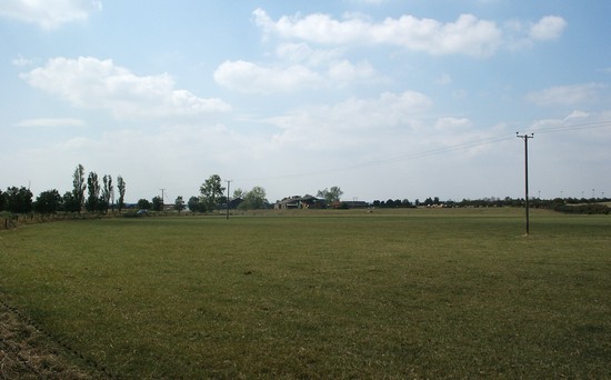
Continue towards South House Farm. It is highly unlikely that there was a settlement here in the 10th century, but note the way the ground rises as you approach the farm. Would such topographical features have been large enough to have a military significance in 991? Go through the farm yard and then pass a house on the right hand side. If this is indeed the area where the battle was fought then somewhere in front of you, in the distance, there must have been an area of woodland in 991, to which many of the English troops fled after Byrhtnoth’s death. At the first hedgerow on the right leave the lane, turning right along the footpath. In the next field the path runs alongside the sports field and then joins Park Drive. Turn right along the road, past the Leisure Centre and the turning to the Recycling site, and enter Promenande Park where you drove in to the car park.


