A Battlefield Walk
ACCESS BY CAR
If travelling by road from Boroughbridge, cross the river Ure at the north end of the town and immediately north of the bridge, at the roundabout, turn right towards Milby. Then, after 400 metres, turn right again to Milby. Go through the village and 700m beyond, where the road takes a sharp left turn, take the narrow road on the right to Ellenthorpe. Follow this road for 1700m, past the turnings to Ellenthorpe Hall and Lodge and, just before Clott House Farm, opposite a 20th century brick house on the left hand side, there is a wide verge on the right hand side where it is possible to park several cars.
THE WALK
2.5 miles (3 miles if Myton village and church are also included). The terrain is easy and the paths are well trodden and easily followed. There is no shop or pub in Myton. The nearest facilties are in Boroughbridge (2 miles).
Follow the track straight on through Clott Hill Farm. Alongside the path on the right, just before the house and then again just beyond it, where the path passes on the south side of the Clott Hill Farm barns, are small paddocks where earthwork ridge and furrow survives. This is a tiny fragment of evidence for the medieval open fields of Ellenthorpe which are likely to have extended across much of not all of the land above the floodplain. To the north of the path were the open fields of Milby.
The path leads on between arable fields on the south, running alongside a hedge on the north side. As the path bears slightly to the right it drops down onto the floodplain of the Swale. Here the hedge on the left now sits upon a high flood defence bank. At the end of the field the path then rises up over another such bank, which continues southward, forming the western boundary of Myton Pastures. This is the best vantage point to look over the presumed western part of the battlefield. The slightly higher ground of Coney Hill, on which the Clot Hill Farm sits, is clearly visible, rising up from the floodplain. This is the site of the Scottish deployment suggested in the English Heritage report.
The path now crosses a tiny modern bridge over the drainage ditch. You are now in Myton parish with the high flood bank on your left marking the northern edge of Myton Pastures. Just past the trees on your right and you see that today, thanks to modern drainage, the Pastures is largely arable and encompassed on three sides by a narrow plantations of trees.
From here turn right and follow down the western side of the Pastures. Half way to the river you pass through a gate into a small area of preserved meadow which takes you down to the flood bank which runs alongside the river bank eastward to the present Myton bridge. Just over half way along the riverbank, where the river meanders slightly, is believed to be the approximate site of the medieval bridge, but the navigation works and construction of flood defence banks have undoubtedly transformed the character of the rivers and riverbanks. On the left the preserved meadow widens out to encompass the earthwork depression which appears to be an abandoned river channel running parallel to the modern channel. At the eastern end of the field a stile leads into a narrow lane. The best views back across Myton Pastures are from the walk along the flood bank beside the river and from here, next to the bridge.
The recently restored 19th century cast iron bridge, which replaced a ferry which was a few metres downstream. The parish council, having completed restoration of the foot bridge, recently placed two interpretation notices on the south and north approaches to the bridge. To the south west, there is a history of the bridge, and to the north west, in a viewing area, they have erected an interpretation panel about the battle.
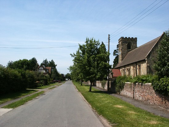
The bridge leads over the river into Myton village. This is only a short walk, though one which adds little to one’s appreciation of the battle. Over the bridge the lane runs on a causeway but on the left one can see how the ground rises up onto the gravel terrace where the medieval village sits. Past a couple of modern houses and the lane turns sharp left into the main street of Myton, a pleasant mix of mainly modern and 19th century brick houses with a few earlier buildings. St Mary’s Church, which is normally open during the day, lies towards this east end of the main street. It is a medieval building, but heavily restored in the later 19th century and contains nothing relating to the battle. (If approaching the battlefield from the village, please park off the road on the wide grass verge adjacent to the church.)
Return to Myton bridge and follow the lane northward, straight across the Pastures to the northern belt of trees then left alongside the trees to cross back over the floodbank and back to Clot Hill Farm.


