The Battlefield
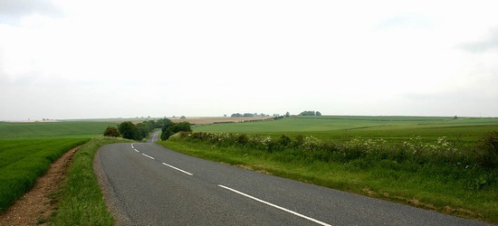
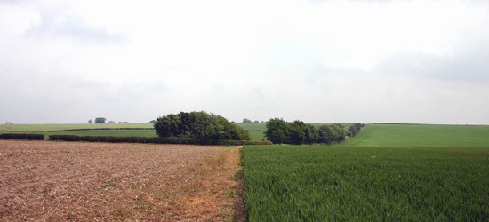
The general location of the battle at Winceby is certain from the contemporary accounts. The broad pattern of the terrain here is also fairly simple and closely restrains the area within which the action can have taken place. The road from Horncastle to Bolingbroke gains the highest ground to the west of Winceby and, after crossing the small valley of the North Beck, follows the ridge top from Winceby until it drops steeply off the Wolds down into Bolingbroke. From the Winceby ridge, starting immediately to the north of Winceby village, the land falls steeply to the north into Snipes Dale. To the south it dips more gently, with this slope broken up by a series of three small, shallow valleys running southward separated by minor ridges. It is across one of these small valleys that the action was fought. Although these broad elements of the terrain are clear, it is still a difficult battlefield to adequately understand, because a key influence on the choice of ground will have been the pattern of hedged fields that will have restricted the room for manoeuvre, and these have not been reconstructed for the mid 17th century. It is therefore uncertain exactly where within the parish the action took place. Three alternative locations have been suggested over the last century or more.
REGISTERED BATTLEFIELD
The first is the westernmost of the three valleys and this is the Registered Battlefield and was already recorded as the battlefield on the 1st edition six inch Ordnance Survey mapping of the 1880s. The deployment for this site is given by Burne and Young (1959, 112) and repeated by English Heritage. They show the royalists deployed on Round Hills Holt and across onto the hill towards Scrafield, with the valley of the North Beck between them and the parliamentarians on the ridge immediately to the north west of Winceby. The terrain broadly fits that which is specified in the contemporary accounts and certainly has a 'small plain' between the two hills. To provide the constraints of ground that the accounts specify the English Heritage report claims the steep slopes of Snipes Dale on the north east and the marsh of Slash Hollow on the south west narrowed the frontage. However there is no justification given for the identification of marsh in Slash Hollow, nor did they make an accurate calculation of the frontages and depths of the formations to determine how well they would have fitted. The interpretation also contains significant internal inconsistency. It gives the royalist deployment crossing into Scrafield on the hilltop, across a putative parish boundary hedge. Later in the action they describe this same hedge obstructing the royalist flight, yet despite this it is assumed that in the initial advance in battle formation the royalist forces were able to advance across this putative hedge and attack without problem. There is indeed likely to have been a hedge here in 1643 as Scrafield is a deserted village and was probably enclosed for sheep farming well before the battle. This would suggest that the deployment did not cross this hedge. It should also be noted that the royalist forces were said to have attacked prematurely because they saw the parliamentarian foot approaching from Bolingbroke. From Scrafield hill the high ground at Winceby almost completely blocks the view of any such advance, even without the trees that now grow around Winceby village.
CENTRAL ALTERNATIVE
An alternative deployment is suggested here which should be assessed alongside the standard site. It takes the next small valley to the east, which lies adjacent to the village. In this case the extent of ancient enclosures around Winceby village will have been the critical factor in determining the width of the ground. A suggestion as to the extent of ancient enclosed paddocks around the village can be gained from the earthworks on the 1940s RAF vertical air photographs. The parish boundary to the south, or the irregularly shaped enclosure just within it, may have provided a southern limit to the field in this location. The frontages calculated for the deployments, using Ward’s military manual, has been shown as an alternative to the standard interpretation on both the Explorer and the terrain maps presented here. Significantly, from the ridge to the west of this small valley one gains a very clear view of the ridge running off to Bolingbroke, and thus if deployed here the royalist would have been fully aware of the parliamentarian infantry approach from more than a mile distant.
EASTERN ALTERNATIVE
A third location is suggested by Robinson (1983) which broadly follows that given in the 19th century by Markham, which he favoured beause of a nearby discovery of burials. The exact site shown by Robinson is clearly wrong as it has the troops on the ridge top and provides no valley between the opposing forces, a key element of the battle according to various of the contemporary accounts. It also shows the troops deployed on the north side across what seems likely from the air photographic evidence to have been hedged paddocks around Winceby village. However there is a third small valley running south from this location which might represent the site of the initial deployments and main action.
In both the second and this third alternatives the action in Slash Lane is interpreted as relating to the rout rather than the main action.
Each of the three sites have the deployments across and controlling the Horncastle to Bolingbroke road, which can be seen from the Ordnance Surveyors’ Drawings of 1820 to have divided in Slash Hollow, one alignment running directly onwards along the footpath over Scrafield Hill while another followed the present route via Round Hills Holt. Unfortunately, in the absence of any published work which accurately defines the road system or the land use and enclosure pattern of the mid 17th century, many uncertainties remain about the character of the battlefield in 1643. As a result it is impossible to determine which of the three sites did actually provide the narrow frontage that the contemporary accounts specify.


