A battlefield walk
5 miles on level ground using footpaths through arable and pasture fields and long minor roads. Parking is not possible on the A4110 and so it is necessary to find a safe parking location within Kingsland village. Unfortunately a circular walk at Mortimer’s Cross is not possible as the A41100 is a fast road lacking adequate verges and so it is necessary to retrace ones steps along the whole route. As a result visitors may prefer to use the driving route. The walk described here is meant to be used in conjunction with the Battlefield OS Explorer map, which can be downloaded from the download area on the left of the screen.
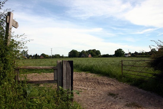
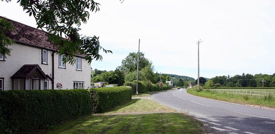
First visit the monument adjacent to the A4110 on the north western edge of Kingsland. Then, facing the monument take the village road to the left (east) of the monument and then the first right down a small, quiet lane to cross the A4110. Though it is shorter to walk along the A4110 this is a fast road and has no verge where it runs around the corner. The stile onto the footpath along the route of the former London-Aberystwyth road is immediately adjacent to the entrance gate to a private house, opposite the lane. It is possible to follow this path across to the Hereford Lane, following almost exactly the course of the early major road along which the Lancastrian army may have marched. Both armies may have deployed in this area, the deployments and the action stretching across to the main road to the east.
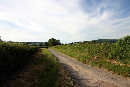
You reach the Hereford Lane between Vernalls Cottage and New House Farm. This is the Roman road which figures in Hodges’ interpretation of the battle as the route of the rebel advance to the battlefield. This is a narrow but very quiet road with wide verges along most of its course. It is therefore possible and safe to walk to Mortimer’s Cross from here, following Hodges’ Lancastrian advance to the battlefield or, alternatively, the line of the rout if the southern battlefield option is correct. In places there are good views of the surrounding landscape. Half a mile north of New House Farm a road a small lane leads in from the left. This junction lies at the heart of the battlefield as suggested by Hodges, the Lancastrians behind you to the south and the Yorkists in front, with the two armies clashing where you stand. This side lane leads towards Ledicot, into a very different landscape of narrow winding lanes, in places highly embanked or deeply hollowed. If you walk about 400 yards along the road you begin to gain a feel for the character of this landscape and get a good view across the plain in which the battle was fought. Hodges argues that this rising ground, in places tree covered, provided right flank protection for the Yorkist army.
Return to the Hereford Lane and continue north. On the left less than 200 yards away the ground now suddenly begins to rise steeply, a scarp which may have been wooded in 1461 just as it is today. When you reach the junction with the A4110 the Blue Mantle Cottages and the site of the Battle or Gospel Oak (now sadly lost) are on your left. On the opposite side of the road a footpath leads across the pasture fields to the bridge over the river Lugg. This is the area where Evans, Haigh and others suggest the Yorkists deployed facing west and where they suggest the battle was fought. Walking the ground shows how improbable this is, because the area is so narrow between river and the steeply rising ground to the west. When you reach the B4362 turn right to the bridge over the Lugg and the adjacent Watermill with its interpretation related to the battle (entrance fee).
Return along the B4362. A milestone stands at the junction with the main road, reflecting the fact that both routes were upgraded as turnpikes in the 18th century. But perhaps more important after a long walk will be the Mortimer’s Cross Inn on the opposite side of the road (not forgetting its sign showing the parhelion).
It is possible to walk back south along the A4110 to Blue Mantle as there is a verge but the rest of the main road is too narrow and the traffic too fast to walk along it all the way to Kingsland, Instead, retrace your steps earlier on the walk along the Hereford Lane and the footpath back to Kingsland.


