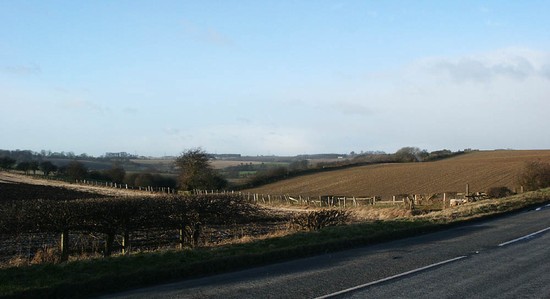
Looking north west, from the Saxton-Towton road, down Towton Dale and Bloody Meadow. Here, at its western end, the dale becomes far deeper as it plunges over the precipitous scarp into the valley of the Cock Beck. The scarp on the western edge of the plateau provided secure protection from any outflanking moves on this side of the battlefield. This must have been an important consideration in the Lancastrians' choice of this plateau as the ground on which to deploy.
Photo: G Foard 30/01/2003; photo number: 064; Grid Reference: 447730,438180
Copyright © The Battlefields Trust 2004
Click here to see the original (larger) version of this image
CLICK HERE TO PRINT THIS PAGE
Close window