Driving to the battlefield
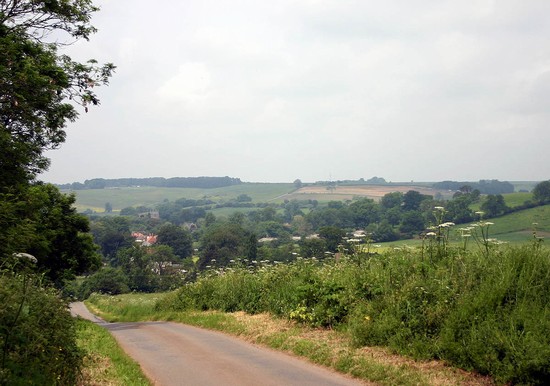
The most interesting approach to the battlefield is along the A16 from Boston, which broadly follows the mid 17th century route across the fenland which the parliamentarian forces would have taken. You will pass through the villages close to the north edge of the fenland where some Eastern Association troops were deployed to guard the rout back to Boston, should the action at Bolingbroke and Winceby have gone badly for them. Viewed from this road the Lincolnshire Wolds, which were in 1643 under royalist control, rise up dramatically out of the flat fenland. When you reach the foot of the Wolds, at Keal, take a minor road on the left to Old Bolingbroke. The approach into Bolingbroke village from the south east gives excellent views from the hill slope across the valley to the ‘Bolingbrooke Hill’ where the parliamentarian forces formed up prior to the battle of Winceby. The battle took place when the parliamentarian forces besieging Bolingbroke Castle had to counter a royalist relief force which was attempting to relieve the siege. Details of access to the castle are given together with other Related Sites listed on the navigation bar on the left.
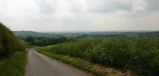
From Bolingbroke, at the junction in the centre of the village, take the road signed to Asgarby and Horncastle. This leads up a steep hill and onto the Wolds, probably along the same route that the parliamentarian forces took to their rendezvous on ‘Bolingbroke Hill’. This is a quiet road but it is difficult to find a place to park and so the excellent views back across the fen to the south cannot be easily appreciated.
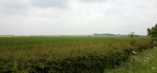
The hilltop is wide and fairly level and this appears to be the area where the Association army had it rendezvous and formed up on the 11th October. The ridge route from here to Winceby is the one taken by the parliamentarian forces that afternoon as the marched out to counter the royalist advance. Once past Asgarby there are distant views across to Winceby, clearly visible by the grouping of trees around the settlement. The landscape today, with its many hedged fields, is undoubtedly very different to that of 1643 when this land was either open field or large sheepwalks with few if any hedges.
Turn left onto the B1195 (For the Country Park, which has public toilets, turn right). Immediately in front of Winceby House Farm, the first house on the right as you enter Winceby village, adjacent to the road is the commemorative stone to the battle which was erected in 1993. There are wide verges here and so it is possible to park briefly, however the stone is included on both the short and the circular walk. A short distance further on, to the right, is the Nature Reserve car park. If this is closed, continue a short distance and take the turning on the right just before the garage. Here it is possible to park on the wide verge. Although there are no views of the battlefield from this location it is probably the most convenient place to park to complete the circular walk and the short walk.
If only completing the short walk then on returning to the car turn round and return to the main road and turn right. The road passes a garage on the right and climbs a slight rise out of the village. This is the ridge on which the royalist forces deployed in our alternative suggested deployment, facing south east; alternatively in the Battlefields Register interpretation it is the parliamentarian position, facing north west. On the ridge top pass the left hand turning to Hameringham and continue down Slash Lane. Just after the road bends to the right there is a small layby on the right hand side of the road, adjacent to a large boulder on the verge. This location gives excellent views across the Registered Battlefield. The layby is just down slope of the suggested royalist deployment. Looking across the shallow valley one can see the suggested parliamentarian position on the rising ground towards Winceby. Slash Lane, along which you have just driven, is on the right. Where it takes the sharp curve towards you the old road originally carried straight on over the hilltop. It is possible to walk down to the corner and take the path through the hedge and up to the right, along the line of the old road, to get a better view from the hilltop, the suggested royalist position, and to see what views they would have had of Cromwell’s cavalry and, beyond Winceby, what they might have seen, if anything, of the ridge to Bolingbroke along which the royalists had seen enemy infantry advancing to the battlefield.


