Driving to the battlefield
This is not a battlefield that can be toured safely by car because the roads are too narrow, the traffic too fast and there are no suitable parking places. However the drive to Lansdown Hill can provide (at least for the passengers) a good introduction to the character of the broader landscape over which the action was fought.
The battlefield lies on and beyond the northern edge of Lansdown Hill. The Grenvile monument, the best starting point for a battlefield walk lies alongside the minor road from Bath to Wick, which passes by Bath Racecourse, and lies a little over two miles north of Bath and about one mile north of the Racecourse. The best approach is however from the north, travelling west along the A420 Chippenham to Bath road. This takes you through Marshfield, the royalist headquarters prior to the battle, and then on past Cold Ashton, the village where the mortally wounded Sir Bevill Grenvile was taken after the battle.
About one mile west of the junction with the A46 there is a picnic site immediately adjacent to and signed from the A420. This is a good stopping off point. There are toilets at the car park and, on a clear day, from the picnic area one gets stunning views of the valley of the Severn. Gaining control of this wealthy agricultural territory and England’s second most important mid 17th century town and port, Bristol, was the main focus of the royalist campaign in the west in 1643. The battle of Lansdown was a vital part of that campaign.
Leaving the picnic area, with care, turn right and cross over the A420 travelling south towards Bath. After 200 metres you pass Tog Hill House Farm. This used to lie on the main London to Bristol road but the modern course of the A420 has long since abandoned the 17th century alignment over Tog Hill that the royalist army would have followed. Your route continues along the ridge extending south onto Freezing Hill, giving excellent views to east and west. Much of this hilltop was open field in 1643 but today it is enclosed by a pattern of rectilinear hedged fields. From the edge of the scarp there is a good view of Lansdown Hill, but now the road plunges down the steep slope as a narrow winding lane entering the anciently enclosed and irregular pattern of small hedged fields that determined the character of the action in the early stages of the battle.
The road now rises again up Lansdown Hill. Whereas on the right the upper slopes are wooded as they probably were in 1643, on the left the character has changed considerably, with the landscaped ground of the house known as Battlefields and trees now covering the upper slopes. The roads have also changed, for half way up the hill you join the Wick to Bath road, but in the 17th and 18th centuries it took a higher course to join at the brow of the hill. It was as they ascended this slope and in trying to take and hold the edge of the plateau that the greater number of the royalists were cut down.
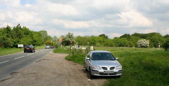
The only location recommended for parking is on the left about 100 metres after reaching the top of the hill, where there is a rough, potholed piece of ground which will accommodate two or three cars. Given the high volume of fast traffic using this road care needs to be taken when parking and when leaving. This is a good location to start a walk over the battlefield.
For those with little time to walk there are two interpretation panels adjacent to the road and it is just 200 metres to the Grenvile Monument. But this will not give a good understanding of the action, for at this point the views from the scarp are wholly obscured by trees.


