Location and Description of the Battlefield
In the west the battlefield consisted of the area of land east of Wood Speen and Stockcross between the rivers Lambourne and Kennet as far east as the enclosures adjoining the open field of Speenhamland on the north side and into the open field on the south side, where Sir William Balfour was defeated by Sir Humphrey Bennett's brigade. The 1780 enclosure map for Speenhamland (which is more helpful than Rocques's detailed 1761 map of the area) indicates there were enclosures to the south and east of Speen at the time of the battle. De Gomme's plan, which indicates the deployment of royalists and parliamentary armies at the so called third battle of Newbury in early November 1644, shows enclosure along the north bank of the Kennet and the division of Speenhamland into two great fields at the bridge over the Kennet into Newbury. The 1729-30 survey map of Speen appears to confirm this as it shows strip fields within larger open fields with enclosure only toward the meadows on the north side of the Kennet. It seems likely that there was some hedged and/or ditched enclosure on the north side of Speen as Waller admitted his cavalry were hindered by hedges. In addition Mercurius Aulicus stated that Cleveland's brigade attacked the parliamentarian cavalry on the left as it was attempting to cross a ditch. Nonetheless the area north of Speen was generally more open than that to the south of the village.
On the eastern side of the battlefield, enclosed fields surrounded Shaw and Shaw House to the north and east. These hedges, along with the buildings and defensive works constructed by the royalists, were the main area of fighting. This combat extended as far north as Brick Kiln wood and up to the top of Clay Hill. There is no evidence that Manchester's men operated south of the Lambourne during the afternoon of the battle, though the early morning attack he launched prior to the main action did involve fighting across Shaw bridge by the mill there.
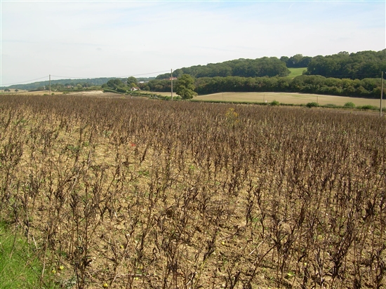
The modern battlefield is much changed from the 17th century, large parts of it having been built over as a result of urbanisation. The construction of the A34 Newbury Bypass in the mid 1990s also cut through a large swathe of Wickham Heath altering the character of the western part of the battlefield. But areas remain. On the western side, the fields to the west of Speen and beyond the A34 as far as Wood Speen and south to the continuation of the hedge line from Moor Lane all have the potential to provide archaeology relating to the battle and allow for a degree of understanding of the terrain over which it was fought. Speen Recreation Ground and Goldwell Park have similar archaeological potential, though their current setting does little to enhance understanding of the battle.
On the eastern side of the battlefield, the fields beyond the Vodaphone headquarters up to the summit of Clay hill (including the school playing fields north of Love Lane, but excluding Shaw Cemetery) and as far north as Brickkiln wood offer battlefield archaeology and terrain understanding potential similar to that identified for the areas around Speen. Shaw House and its surrounding grounds are also part of the battlefield, but are already a scheduled monument.


